Sonoran Desert Ecosystems
The Sonoran Desert could be referred to as one of the most architecturally varied natural environments in the world, with its towering saguaro cacti, barrel species, furry teddy bear cholla, sprawling ocotillo, branched paloverde species, and understory of grasses and colorful flowering forbs, as depicted in the image above. This complex of life-forms is a product of abiotic variables: soil, climate (specifically biseasonal precipitation), community ecology, evolution, and environmental gradients. The extensive niches in this system provide habitat to hundreds of species of birds, bees, butterflies, mammals, hummingbirds, and reptiles. Like the Mojave, the Sonoran also has a respectable number of endemic species and is under considerable human land-use pressures.
Section 1: Physiography
Geographic Location
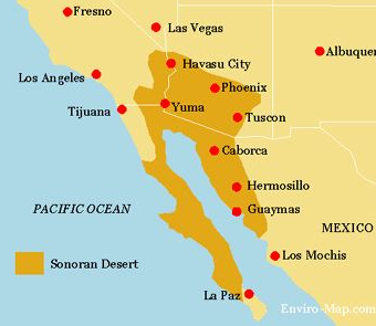
The Sonoran Desert spans approximately one hundred thousand square miles split fairly evenly between the US and Mexico. Most of the US portion of the desert is located in the southern portion of Arizona (figure 11.1). It is a mosaic of isolated mountain ranges with bajadas that flow into flat valley areas.
Climate
Most of the Sonoran Desert, at least the area with which we are most familiar, is influenced by biseasonal precipitation: winter frontal storms and summer monsoons. Winter storms develop in the Pacific Northwest, and because westerly winds drop to about thirty-five degrees latitude in the winter, it generally isn’t enough to bring precipitation to the Sonoran Desert; however, occasionally, low-pressure troughs develop that push the storm fronts farther south into the Sonoran Desert.
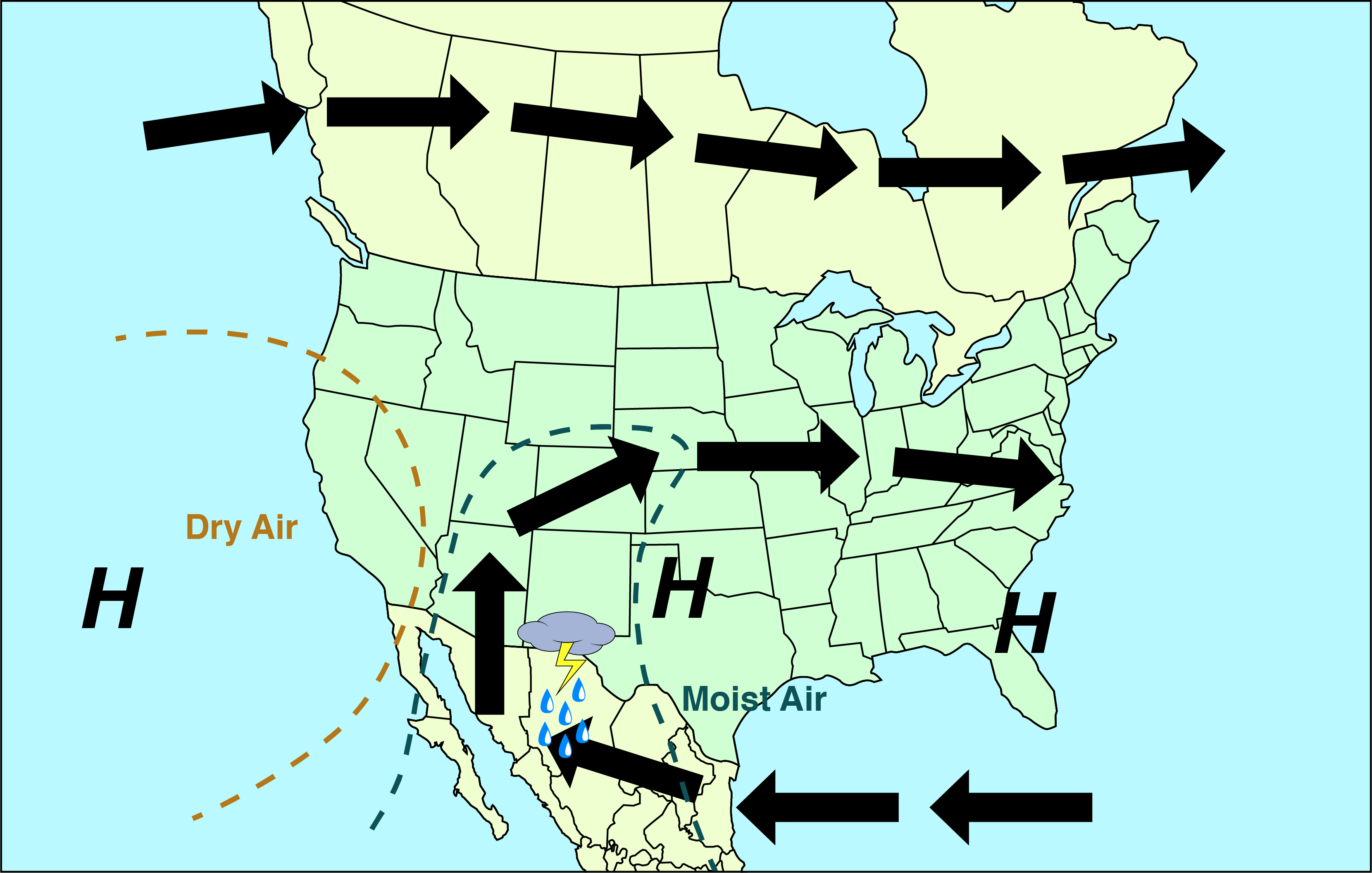
Summer monsoons are a product of moist air off the Gulf Coast circling inland and buffered by dry air off the Pacific Coast, and when it hits the mountains, the orographic effect comes into play, and it rains intensely for short durations of time (figure 11.2).
To an outsider, the Sonoran Desert is simply just hot and dry, and there is little to no seasonality, but to someone who lives there, it may be argued that there are five seasons:
- Summer monsoon: early July to mid-September
- Autumn: October through November, characterized by warm temperatures and low humidity
- Winter: December through January, characterized by mostly sunny mild days with frontal storms
- Spring: February through April, characterized by mild temperatures, minimal precipitation, winter annuals flower
- Foresummer: May through June, characterized by high temperatures and aridity with most flowering perennials blooming in May
Sky Islands, Elevation, and Gradient of Biomes
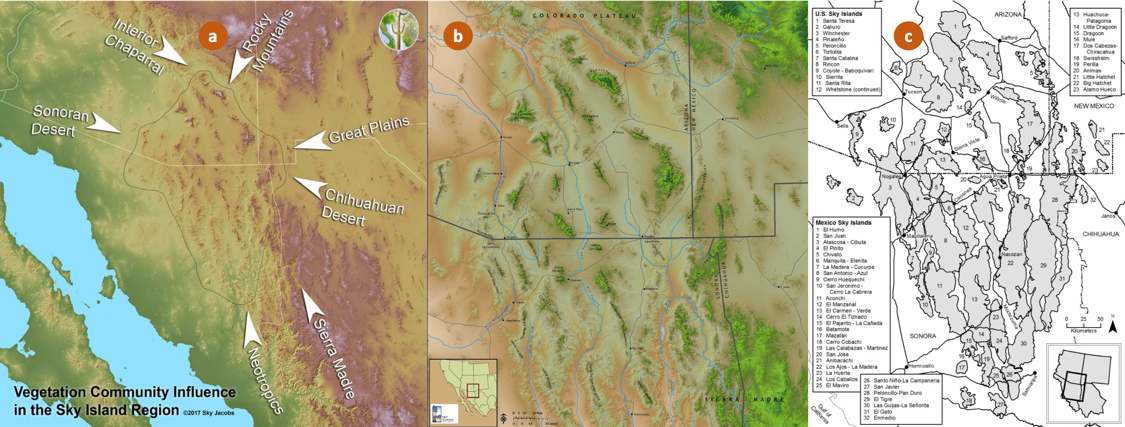
The Sky Island Region is about forty-five thousand square miles of sixty-five isolated mountain ranges rising up from the desert as a result of the convergence of several major biogeographic areas (Chihuahuan Desert, Sonoran Desert, Colorado Plateau, Southern Rocky Mountains, and the Northern Sierra Madre Mountains; figure 11.3). This convergence, in conjunction with the elevation gradient of the Sky Islands, results in extreme biodiversity across the region, to the degree that the International Union for the Conservation of Nature has declared it an area with the greatest plant diversity outside of the tropics.
One mountain within the region provides habitat to more than 50 percent of the bird species and the greatest diversity of mammal species in the US. It is estimated that more than 150,000 invertebrates, 100 mammals, over 2,100 plant species, and hundreds of species of bees inhabit the Sky Island Region. It is an area that is an active range to about a dozen endangered mammals, including the jaguar.
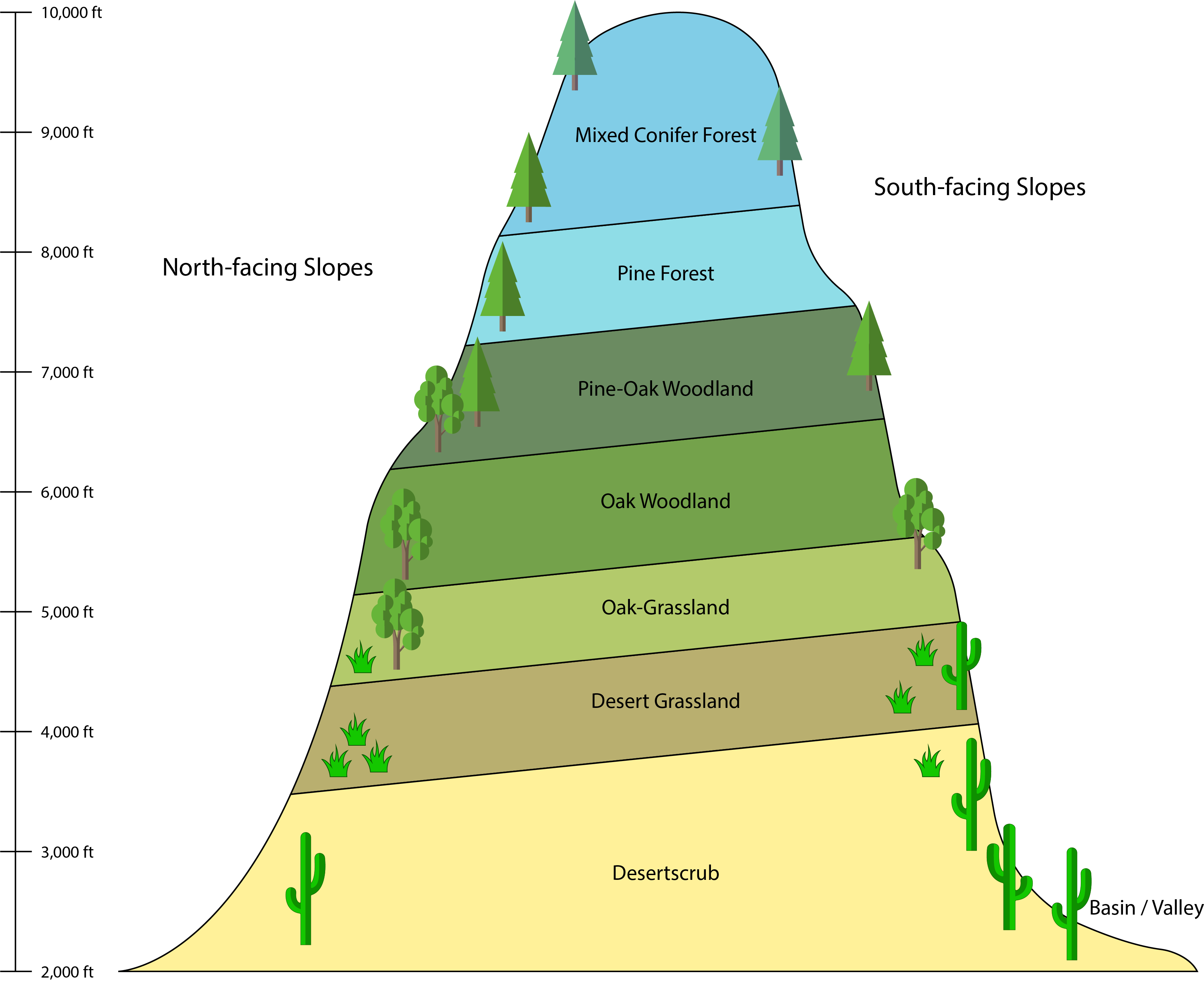
Eight biomes are present along the elevation gradient (figure 11.4). As with each one-thousand-foot elevation gain, the temperature generally drops four degrees, and precipitation increases by 4.5 inches due to the orographic effect.
Section 2: Classifications
Like the Mojave Desert, the Sonoran Desert is not short on classifications schemes that reflect the diversity of systems spanning over 100,000 square miles (~50,000 square miles in the US). One group has divided the Sonoran Desert up into “subdivisions,” another group into “regions,” and of course we have Major Land Resource Areas (MLRAs); however, only two encompass the Sonoran Desert.
Subdivisions
There are six Sonoran Desert subdivisions, of which two are present in the US and the remainder on the Baja Peninsula and Northern Mexico in the Sonoran Province (figure 11.5).
Lower Colorado River Valley is the largest subdivision, with the Colorado River cutting through it. It is the most arid subdivision with low precipitation distributed irregularly across the subdivision, as such vegetation diversity is low and largely dominated by creosote (Larrea tridentata) and white bursage (Ambrosia dumosa). Soils in the Lower Colorado Valley subdivision are products of alluvium fans, wind erosion, and drought. Large soil extents have a caliche layer and/or desert pavement (covered in the section below). Extensive sand dunes stretch across the subdivision, connected to a system of flats populated with perennial grasses and shrubs. Washes and riparian areas have the highest levels of biodiversity, which include palo verde, perennial legumes, and mesquite species. In more saline soils of riparian areas, Atriplex species occur. Low-lying mountains support a variety of cacti-shrub communities.
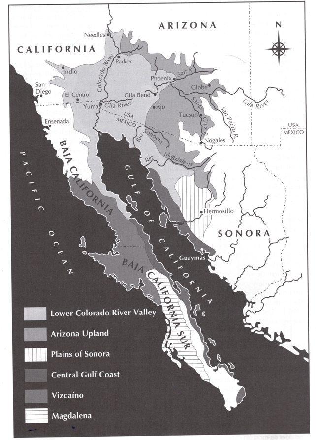
Arizona Upland encompasses some of the wettest, coldest, and highest-elevation portions of the Sonoran Desert, and as such, it has a high degree of biodiversity. Rainfall in this subdivision is biseasonal, with relatively equal amounts distributed between winter storms and summer monsoons. Creosote and white bursage interspersed with acacias species dominate valleys and lower portions of bajadas. Ascending in elevation subtrees such as mesquites, paloverde species and ocotillos are intermixed, which give way to paloverde—saguaro cactus forests (figure 11.6).
Magdalena Plain is the southernmost subdivision located on the Baja Peninsula. Creosote is dominant, but several species of cacti, paloverde, and Opuntia species have a strong presence.
Plains of Sonora is the smallest subdivision, located in the Sonoran Province of Mexico. It is dominated by randomly dispersed clusters of small trees, shrubs, and columnar cacti species, including ironwood (Olneya testa), paloverdes, mesquites, and brittlebush (Encelia spp.).
Central Gulf Coast is split on either side of the Gulf of California and has a north-south vegetation gradient; further, the Baja-side vegetation is more diverse than the mainland side. Vegetation is a sparse mix of subtrees and tall cacti with shrubs mixed in across rocky soils.
Vizcaino borders the Pacific Ocean to the west, which influences a lessening diversity vegetation gradient from coast to inland areas. Boojum cacti (Fouquieria columnaris visually dominates across the subdivision, while ragweed (Ambrosia chenopodiifolia) and Shaw’s Agave (Agave shawii) generally dominate in density. Variations of associated species are related to the vegetation gradients across this subdivision.
Subregions
Author’s note: Given the varying classification schemes applied to the Sonoran Desert, this section outlining subregions will briefly geographically place the subregion, provide any interesting facts, and focus mostly on images of the region.
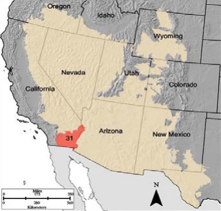
Colorado Desert aligns with MLRA D31 and the Lower Colorado River Valley subdivision. It is roughly seven million acres and encompasses the agricultural production strongholds of the Coachella and Imperial Valleys.
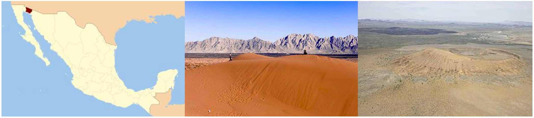
Gran Desierto de Altar is a small region in Northern Mexico just over the US-Mexico border. It is a region with the only active erg dunes in North America. Erg dunes are those that are continuously being formed and reshaped by wind and are generally devoid of vegetation. This region also encompasses a UNESCO World Heritage Site—El Pinacate y Gran Desierto de Altar Biosphere Reserve. The mountains of this area are volcanic chains.
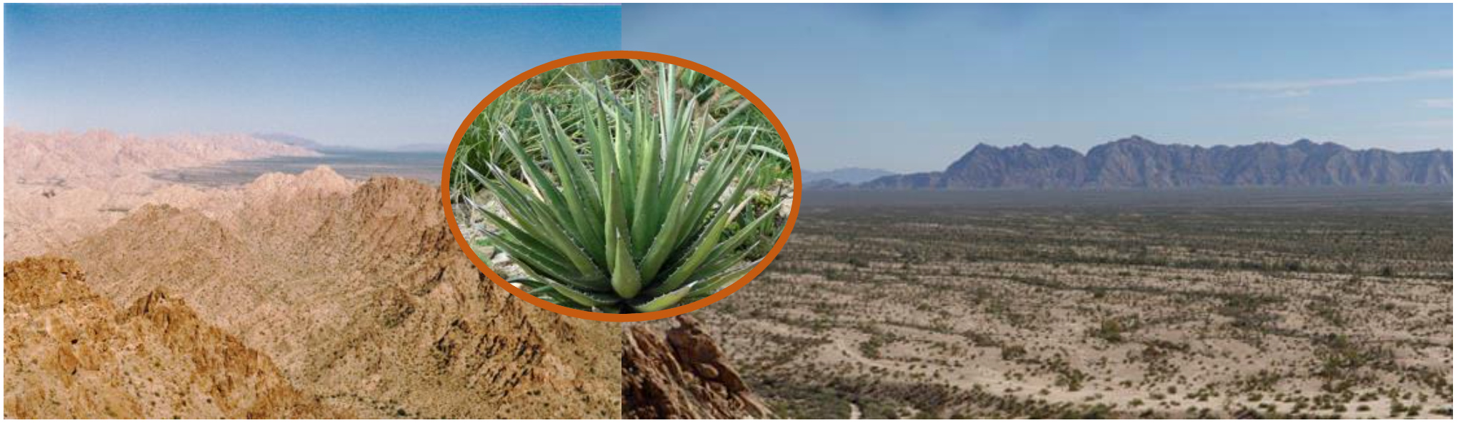
Lechuguilla Desert is a small region on the north side of the Gran Desierto de Altra in Arizona. The region is named for the extensive presence among creosote and bursage of Agave lechuguilla, which is generally found in the Chihuahuan Desert.
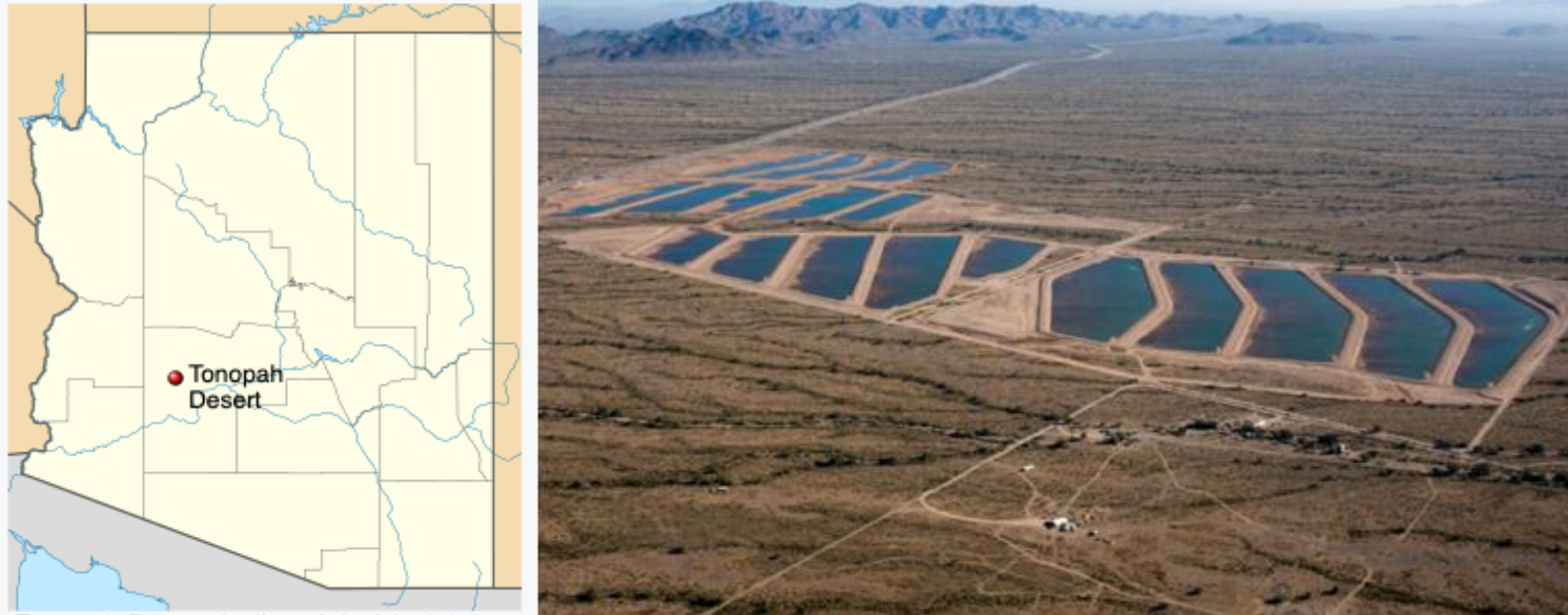
Tonopah Desert is only about thirty miles long and is just south of the intersection of the Gila and Hassayampa Rivers. It is in MLRA D40 and the Lower Colorado Yuha Desert. Conservation efforts continue to protect and recharge the overdrawn Tonopah Aquifer that lies below this region.
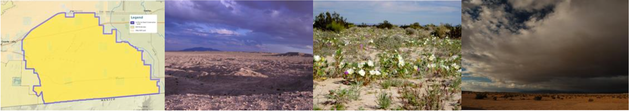
The region in the Imperial Valley of California along the border with Mexico once was the lake bed of the ancient Lake Cahuilla. It is also the site of the passage of the de Anza expedition. Culturally, archeologically, and ecologically, the Yuha Desert is a critical area that is currently under extensive conservation status.
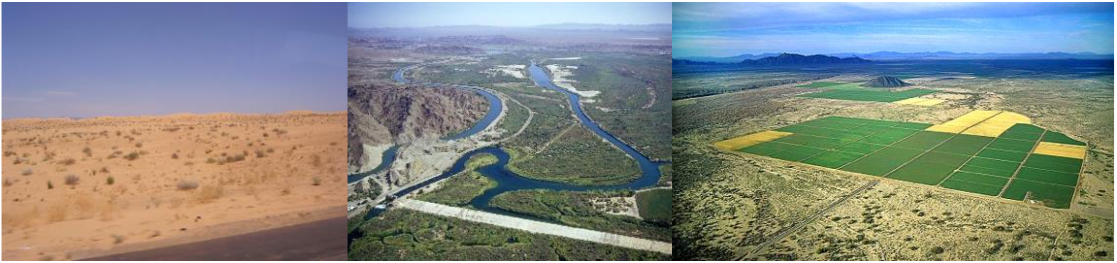
Yuma Desert is a largely barren, wind-blown desert that is highly irrigated to produce crops in the valley areas located between the Gila and Colorado Rivers in Southern Arizona. Most of the irrigation water comes from a heavily dammed Lower Colorado River, which largely prevents water flow to the lower reaches in Mexico. The military has a large presence in this area.
MLRAs
D31 Lower Colorado Desert is largely in California, situated south of the Salton Sea, with numerous wilderness areas and Native American reservation lands. The topography is a mix of mountains, alluvial fans, and valleys. Elevation ranges from 275 feet below sea level to elevations above 1,650 feet. It is within the Lower Colorado River Valley subdivision. Vegetation patterns reflect the intense competition for water and resources. Although this region has low precipitation, irrigated agriculture production is a major land use.
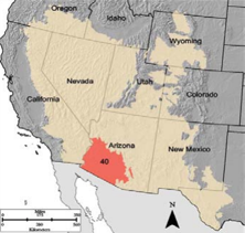
D40 Sonoran Basin and Range is extensively in Arizona, encompassing the major cities of Yuma, Phoenix, and Tucson as well as two major Native American reservations (Gila Indian River Community and Tohono O’Odham). Its topography is a mix of fault-block mountains ranging in elevation from 1,000 to 4,600 feet and valleys. Most of the valleys are covered with young deep alluvium washed out from surrounding mountains. The area has experienced intense volcanism in the geologic past, with some granite outcrops over one billion years old. Three major rivers flow through this region: Lower Colorado, Gila, and Salt. Most of the population of Arizona lives in this MLRA, and as such, over six million gallons of water are withdrawn daily (40 percent ground; 60 percent surface). Like many areas in the West, about 50 percent of this MLRA is federally managed. Major conservation concerns are water scarcity, soil stability, and biodiversity.
Section 3: Soils
Many soils through the valleys of the Sonoran Desert are the result of alluvium washouts, with three commonly occurring characteristics: calcic and argillic horizons, areas of desert pavement, and soil crusts, which were discussed in chapter 10.
Calcic Horizon
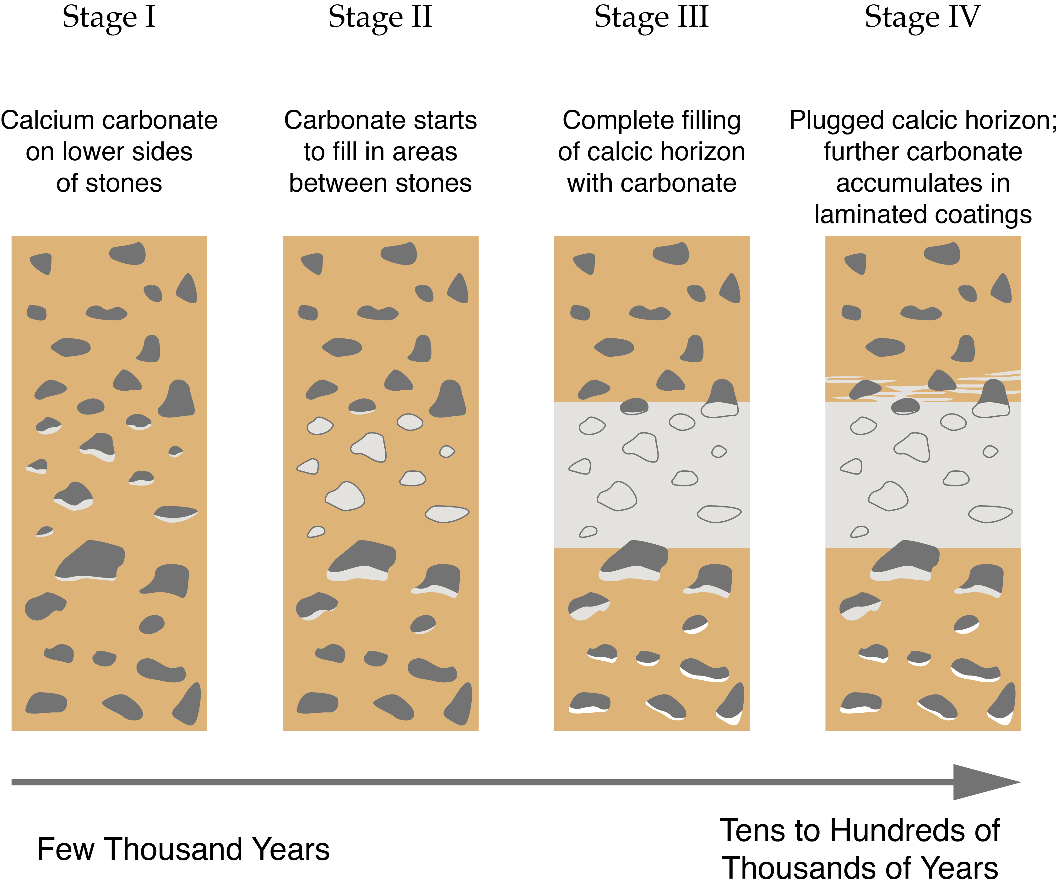
This is the buildup of calcium carbonate into a layer within the soil profile. Precipitation regime is the driving factor determining the depth of the calcic horizon; the more precipitation, the greater the depth. Calcic horizons take a long time to form; figure 11.15 depicts the formation process. For many years, the source of calcium was a bit of a mystery, as the parent material doesn’t contain high quantities of calcium. It was determined that a predominant source of calcium was a result of wind-driven deposition. This accumulation of calcium carbonate results in soil pH levels above 7 (which means more alkaline).
Argillic Horizons
Clay-rich layers, often rusty red in color, are referred to as argillic horizons (a.k.a. claypans; figure 11.16). The reddish colors are a result of the oxidation of iron-bearing minerals. These horizons are also formed over a long period of time as a result of water carrying clay particles that accumulate. Desert soils of Pleistocene deposits generally have argillic horizons, while those formed in the Holocene do not or have weak argillic horizons because their time in residence has not been long enough. Soils with a high calcium carbonate concentration do not have argillic horizons, as calcium carbonate causes clay particles to clump together rather than disperse in water. These claypan horizons can impede water movement and rooting depth.
Desert Pavement
Desert pavements are areas of small packed stones that make a relatively flat surface devoid of vegetation (figure 11.17). Most desert pavements are in the most arid locations and develop on stony alluvial fans. They, like most soil characteristics, form over time, driven by physical processes (figure 11.18).
Section 4: Biodiversity
If there is one word to describe the Sonoran Desert, it may be diversity. Estimates vary, but in general, there are likely well over five thousand species throughout the Sonoran Desert.
The concept of biological diversity (a.k.a. biodiversity) was first defined by E. O. Wilson. His perspective of the concept was the degree of interconnectivity within an ecosystem, which is more complex than what is generally inferred by the term biodiversity today—species richness. To understand the complexity of the Sonoran Desert across spatial and temporal scales; the context of its rich history of native cultures, geologic events, and modern-day human impacts; and the biology and ecology of thousands of native and/or endemic species, we require Wilson’s perspective of biodiversity, which encompasses genetic diversity, species diversity, interaction diversity, ecosystem diversity, and cultural diversity.
Genetic diversity in the Sonoran Desert is extensive given the number of species within each taxon. For example, there are over one hundred to two hundred butterfly species and five to ten times the number of moth species. It is estimated that one-third of the species native to the Sonoran Desert are endemic, meaning they only inhabit the Sonoran Desert. On the Baja Peninsula alone, there are approximately 550 endemic plant species.
Species diversity—the number of species in a given area and their relative abundance—across the Sonoran Desert and within ecosystems is considerably high, particularly given the gradient of ecosystems. The biseasonal precipitation also is a substantial factor influencing species diversity. For example, in the Tucson Basin, researchers found twenty species of wildflowers within a single square yard and seventy-five to one hundred native plant species sharing roughly a quarter acre.
Often not considered but a strong diversity factor across the Sonoran Desert is functional or interaction diversity—the multitude of niches occupied and roles species play as well as the number of species filling those functional roles within the cycles of the ecosystem. For example, pollination is a widespread functional activity throughout the Sonoran Desert. In the Huachuca Mountains, hummingbirds, bees, butterflies, and bats all share the pollinating function. Another example that is multilayered, reflecting the complexity of Sonoran Desert ecosystems, revolves around the life of the saguaro cactus. A nurse plant facilitates the beginning of the life of a saguaro cactus by providing shelter and protection, only to have the tables turned when the saguaro cactus overtakes the nurse plant and increases competition for the plant, often outcompeting the plant. When a Gila woodpecker (Melanerpes uropygialis) excavates a nest in the upper third of a mature saguaro and then abandons it, other birds utilize the cavity for nesting or as a source of food. Some hawk species use areas where saguaro arms branch out to build nests, and other raptors use the cactus as a hunting perch. Not to mention all the insects that feed off areas where the outer layer of the cactus has been removed or damaged.
As noted above, there is an elevation gradient of ecosystem diversity, particularly in the Sky Island regions where scrub desert transitions to woodlands to conifer forests. There is also ecosystem diversity across the Sonoran Desert, from coastal areas to inland mountains. Areas around water bodies often have a diversity of ecosystems ranging from rivers to riparian and wetland areas to saltgrass flats transitioning to woodland areas or agricultural fields, such as the case in the Colorado River Delta in the southern reaches of Arizona and Northern Mexico.
The cultural diversity of the Sonoran Desert may be the greatest in the US, with seventeen Native American tribes, all sovereign entities with rich cultural histories and traditional ecological knowledge guiding land and resource management. This is in addition to Anglo and Hispanic presence and management approaches.
The high degree of biodiversity across the Sonoran Desert is threatened by an estimated 350+ invasive species, resulting in approximately 60 percent of the desert area no longer covered with native species. Buffelgrass is of serious concern as well as Africanized bees and cowbirds (parasitic bird species that take over the nests of native bird species). Urbanization, recreation, and water development projects have fragmented the habitat and are placing a great deal of stress on water resources throughout the desert. More water is being pumped out of aquifers than is recharged to support urban development and agriculture, and this lowers the water table, making water inaccessible to many plants.
Section 5: Current Anthropogenic Stresses and Conservation
As noted throughout the chapter, the Sonoran Desert is under the same types of pressures as the Mojave Desert: invasive plants, land conversion, habitat fragmentation and destruction, off-road vehicle traffic, recreation, drought, and water and resource management. One stress generally missing from the mix is mineral extraction; however, as noted above, water extraction is such that its impacts are substantial on ecosystems, particularly those in the Phoenix-Tucson-Southwest Arizona regions. Of particular concern are the impacts on the vast array of pollinator species throughout the Sonoran Desert, species that not only pollinate native plants but are vital for agricultural production.
