Sagebrush Ecosystems
Sagebrush ecosystems are located throughout the Great Basin, but they are considered by many to be an endangered ecosystem due to invasive species proliferation (particularly cheatgrass [Bromus tectorum]), alternations of fire regimes, and land conversion and uses (e.g., urbanization, dryland farming, overgrazing). The peril face by the sagebrush ecosystem has been brought to light by its namesake species—sage grouse (Centrocercus urophasianus), whose populations have declined to the point of being considered a threatened species because of loss of habitat.
Section 1: Geographic Distribution
Geographic Location
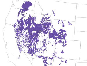
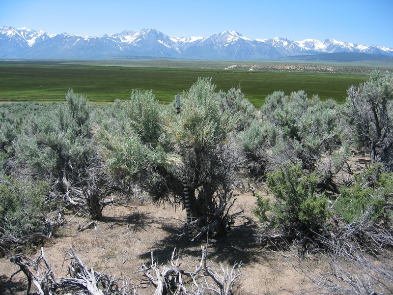
Sagebrush steppe is located throughout the regions of the Intermountain West, the Columbia and Colorado Plateaus, and the Great Basin in the states of Washington, Oregon, California, Idaho, Nevada, Wyoming, Utah, Colorado, Arizona, and New Mexico (figure 8.1).
Section 2: Major Land Resource Areas of Sagebrush Ecosystems
Sagebrush ecosystems are present in varying extents and densities throughout the following Major Land Resource Areas (MLRAs):
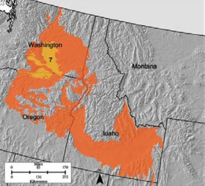
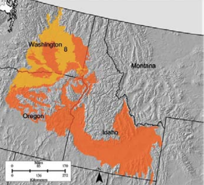
- Region B-7 Columbia Basin
- Region B-8 Columbia Plateau
- Region B-10 Central Rocky and Blue Mountain Foothills
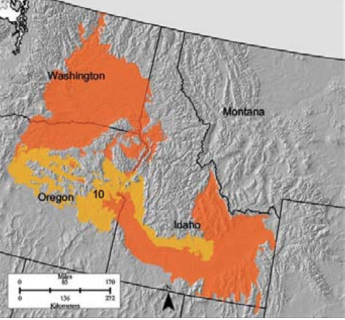
- Region B-11 Snake River Plains
Sagebrush is present in Regions B-12 Lost River Valleys and Mountains and B-13 Eastern Idaho Plateaus, but these areas are dominated by bunchgrass, grass, and forb species.
- Region D-23 Malheur High Plateau
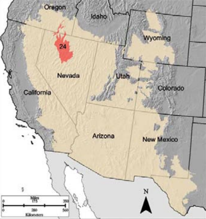
- Region D-24 Humboldt Area
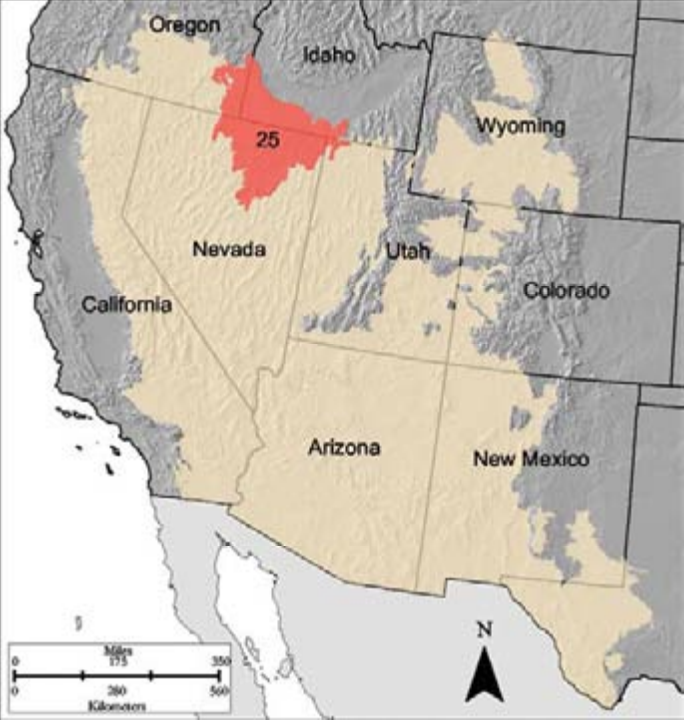
- Region D-25 Owyhee High Plateau
- Region D-26 Carson Basin and Mountains
- Region D-32 Northern Intermountain Desertic Basins
- Region D-34A Cool Central Desertic Basin and Plateaus (higher precipitation)
- Region D-35 Colorado Plateau (sagebrush and pinyon-juniper)
- Region D-36 Southwestern Plateaus, Mesas, and Foothills (sagebrush and pinyon-juniper)
Each MLRA has reflective physiography, geology, climate, water, soil and biological resources, and associated land uses. There is a great degree of variation across the MLRAs of sagebrush ecosystems in terms of climate, topography, soil, plant species composition, hydrology, and community dynamics. This text will look at each system through an MLRA lens. To find out more information about specific MLRAs, the US Department of Agriculture Handbook 296, Land Resource Regions and Major Land Resource Areas of the United States, the Caribbean, and the Pacific Basin, is available online, as well as interactive MLRA maps.
B-Region MLRAs
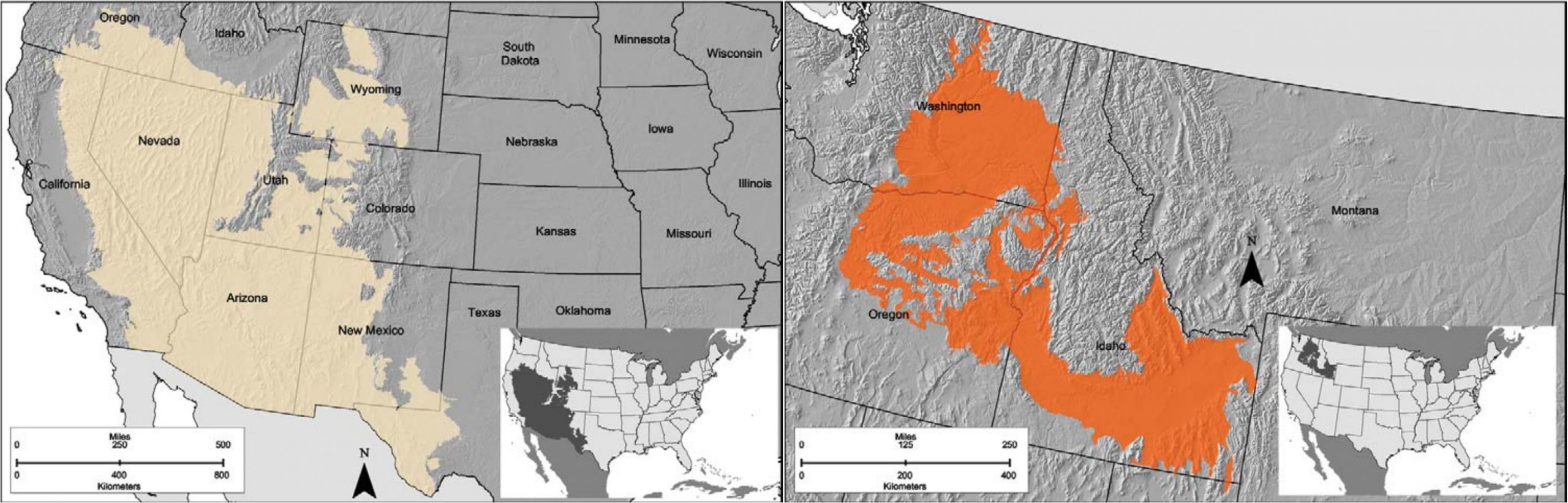
This region comprises plains and plateaus across 81,225 square miles of Idaho, Washington, Oregon, and a small area of Utah, on the leeward side of the Cascade Mountains (figure 8.2). The topography of the region ranges from smooth, rolling plain dissected by rivers and streams to steep slopes, and young incised valleys. Alluvial fans of glacial washout are prevalent in some northern areas. The formation of the area’s topography and soils were heavily influenced by Missoulian floods. Soils across the region are dominantly and moderately deep to very deep well-drained Aridisols and Entisols.
Precipitation occurs mostly in fall, winter (snow), and spring as a result of low-intensity storms in the form of rain or snow. Summers are generally dry. Out of all the land resource regions, this region uses the largest amount of water (91 percent of it for irrigation). Although the region is underlain with basalt aquifers, most of the water use is from surface waters of the Snake and Columbia River systems. Mollisols, Aridisols, and Entisols are the dominant soil orders of the region.
B-7 Columbian Basin vegetation communities are shrub-grass associations comprised of big basin sagebrush (Artemisia tridentata) and Wyoming big sagebrush (Artemisia tridentata wyomingensis). Understory grass is dominated by bluebunch wheatgrass (Pseudoroegneria spicata). In sandier soil areas, needle-and-thread grass (Hesperostipa comata) and bitterbrush (Purshia tridentata) are dominant. In inland riparian areas, saltgrass (Distichlis spicata), basin wildrye (Leymus cinereus), and greasewood (Sarcobatus vermiculatus) are dominant.
B-8 Columbia Plateau vegetation communities are similar to those in the B-7 Columbia Basin region; however, Idaho fescue (Festuca idahoensis) are dominant among sagebrush on north-facing slopes. In warmer areas, there are stands of ponderosa pine (Pinus ponderosa) with a Snowberry (Gaultheria spp.) shrub understory, and in warmer and more mesic areas there are oak species (Quercus spp.) and dwarf hardwoods.
Blue Mountain Foothills vegetation communities are similar to those in the Columbia Basin Region with the addition of antelope bitterbrush (Purshia tridentata) in more mesic areas, and western juniper (Juniperus occidentalis) on rocky outcrops. Due to a history of fire suppression and a reduction in the shrub understory, western juniper has expanded into shrub-grass communities to the extent that the species is becoming increasingly dominant. The Columbia Basin and Plateau regions are upland salmon and trout stream and spawning habitat.
Landownership and management in B7 and B8 are largely private, while in B-10 about half of the region is federally managed by the Bureau of Land Management (BLM). The regions are generally used for livestock grazing, with hay, small grains, and some herbs and vegetables grown in areas in close proximity to surface water. Overgrazing, riparian area degradation, woody species encroachment, and reductions in native grass species are primary concerns across all three regions. Much of the region is challenged by soil erosion, invasive species, and soil compaction. Conservation practices include: brush management, prescribed burning, native plant seeding, and riparian area restoration.
D-Region MLRAs
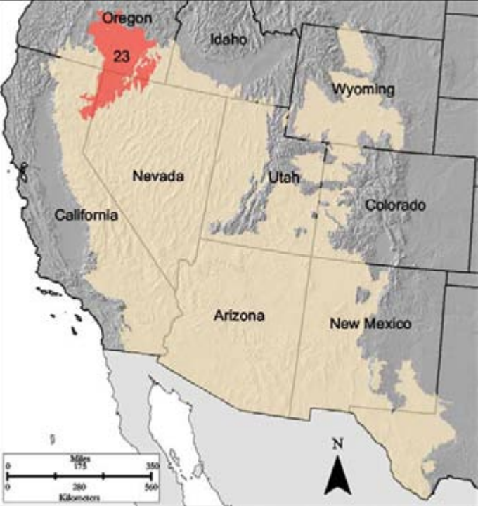
Region D is the largest of the land resource regions. It consists of desert or semidesert plateaus, plains, basins, and isolated mountain ranges across 549,725 square miles of California, Nevada, Oregon, Utah, Arizona, western New Mexico, Colorado, and central portions of Wyoming (figure 8.2). It is a region comprised of plains, basins, valleys, and moderately steep plateaus. North-south fault-block mountain ranges separate basins in some areas. Elevation ranges from 3,900 to 6,900 feet, with some mountain peaks upward of 9,000 feet.
Precipitation ranges from six inches in the lower-lying areas to forty-two inches in the mountains. Warm-season monsoonal precipitation dominants in the southern portions, while cool-season winter storms are the source of precipitation in the northern areas of the region. Annual average temperatures range from 40°F to 60°F along a gradient increasing in temperature from North to South, which is reflected in the spectrum of frost-free days: 105 in the north to 260 in the south. Given the aridity of the area, it is worth noting that daily water draws across the region average more than thirty billion gallons a day.
Surface water is the primary source for use, although streams are intermittent, as they are driven by snow melt runoff. Due to high evaporation rates, salt accumulation is high, which reduces the quality of water when precipitation events occur and water pools in basin areas. Although there is a large supply of groundwater, it is trapped beneath alluvial-fan-driven gravel and sand-filled basins and valleys.
Land uses are primarily cropping, grazing, and recreation; however, cropping is a very minor land use for the regions included in this text. Sixty percent of the region is federally managed and largely used for grazing. Much of the region is challenged by a history of overgrazing, woody species encroachment, soil erosion, invasive species, and increasing pressures from outdoor recreation. Conservation practices include brush management, prescribed burning, native plant seeding, and riparian area restoration.

The D-23 Malheur High Plateau is a 22,895-square-mile area across Oregon, Nevada, and California; it includes no major cities and has one major highway crossing a small section of its southern portion. Alluvial fans, playas, and large areas with ash particles and glassy minerals are characteristic of the region. Dominant soils are Aridisols and Mollisols.
Vegetation communities are similar to those of MLRA Region B, with the addition of silver sage (Artemisia cana) in wetter areas along la playa edges and halophyte species such as saltbush (Atriplex canescens). Aspen groves and Douglas fir stands occur at higher elevations.
In the D-24 Humboldt Area, 93 percent of which is in Nevada, this region of 12,680 square miles is a series of North-South fault mountains interspersed with wide alluvium and lacustrine valleys (elevation ranges from 3,000 to 5,900 feet), most of which drain to the Humboldt River. Soils are generally well drained, a deep and loamy mosaic of Aridisols, Entisols, Inceptisols, and Mollisols.
In areas with precipitation greater than eight inches, big basin sagebrush is the characteristic plant. On drier sites, shadescale (Atriplex confertifolia) and bud sagebrush (Picrothamnus desertorum) are dominant. Grass species in the region include Thurber’s needlegrass (Achnatherum thurberianum), bluebunch wheatgrass (Pseudoroegneria spicata; wetter sites), and Sandberg bluegrass (Poa secunda).
The area of the D-25 Owyhee High Plateau is adjacent to the Humboldt Area MLRA and covers 28,930 square miles into the southeast corner of Oregon, southern Idaho, and a very small area of northwestern Utah. It has similar characteristics to the Humboldt Area; however, its topography and soils are the product of volcanic activity and resulting basalt flows. Like other D and B regions, vegetation is dominated by big and low sagebrush with an understory of bluebunch wheatgrass with the addition of western wheatgrass (Pascopyrum spp.) and a variety of other grasses and forbs. Woody species, such as juniper, curly leaf mountain mahogany (Cercocarpus ledifolius), snowberry, and ceanothus species, are found on high plateaus. At higher elevations vegetation shifts to conifers.
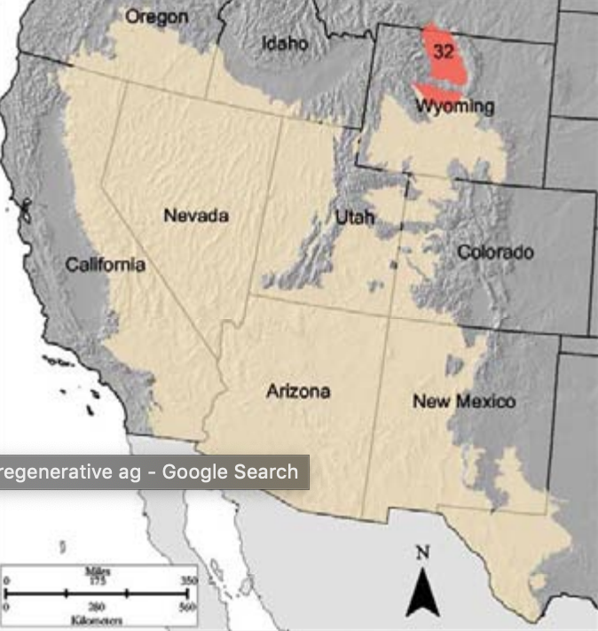
The D-32 Northern Intermountain Desertic Basin is 8,910 square miles of basin areas among mountains largely in Wyoming. The Aridisols and Entisol soils of the area are the product of mountain drainage. Prevalent are big sagebrush species, black sage (Artemisia nova), and Gardner’s saltbush (Atriplex gardneri), with an understory of wheatgrasses, Indian ricegrass (Oryzopsis hymenoides), and other grasses.
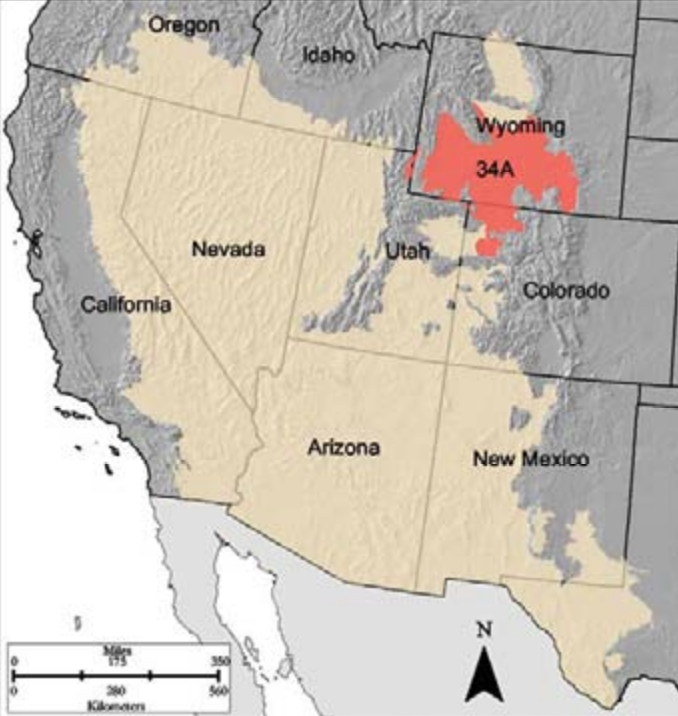
The D-34A Cool Central Desertic Basins and Plateaus region, just below the Northern Intermountain Desertic Basin, is 33,005 square miles, also largely in Wyoming with small reaches into Utah and Colorado, and bounded by mountains. The area’s geology is similar to the Northern Intermountain Desertic Basin region; however, it encompasses three distinct vegetation zones delineated by precipitation:
- The Salt Desert Zone receives less than eight inches of precipitation and is dominated by shrub species, such as four-wing saltbush (Atriplex canescens), greasewood (Adenostoma fasciculatum), shadescale (Atriplex confertifolia), bud sagebrush (Picrothamnus desertorum), and winterfat (Krascheninnikovia lanata).
- The Grass-shrub Zone, receiving eight to sixteen inches of precipitation, is a typical sagebrush steppe region that may be dotted by Utah juniper (Juniperus osteosperma). Cottonwoods and willow species line riparian areas.
- The Foothill-Mountain Zone receives more than sixteen inches of precipitation to support a pine system with an understory of big sagebrush, Saskatoon serviceberry (Amelanchier alnifolia), antelope bitterbrush, and bunchgrasses.
The D-35 Colorado Plateau encompasses some of the most beautiful landscapes in the Southwest, at least by your author’s standards. This region is 71,735 square miles largely in Arizona, but with reaches into southern Utah and northwest New Mexico, and a small corner of southwest Colorado. This region is home to the heavily used Canyonlands, the Grand Canyon, Grand Staircase–Escalante, and the Navajo Nation. It is a mix of deep canyons, plateaus, basins, and isolated mountains as a result of uplift and rivers. Whereas surface water was the primary source in most regions discussed, groundwater is the source in this region. Vegetation shifts to sagebrush mixed with a pinyon-juniper system; the grama grasses (Bouteloua eriopoda and Bouteloua gracilis) form the understory, among other grass and shrub species. Soil salinity becomes an increasing issue in areas of this region.
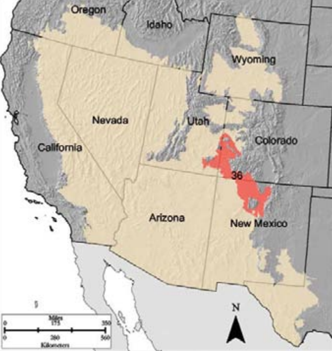
D-36 Southwestern Plateaus, Mesas, and Foothills, in which the author of this text lives along with a number of Native American tribes, is 23,885 square miles across southwest Colorado, north-central New Mexico, and a small area in southeastern Utah. Distinctive on the landscape are horizontal layers of sedimentary rock from the Jurassic, Cretaceous, and Tertiary periods that have eroded into plateaus, mesas, hills, and canyons. While the Colorado Plateau relied on groundwater, this region relies on the surface waters of the Dolores, Animas, and San Juan Rivers. Vegetation is similar to the Colorado Plateau region with the addition of firs and pines at higher elevations and Gambel oak (Quercus gambelii) among the pinyon-juniper system. Prairie dogs, bears, and coyotes are particularly challenging in this region, as is extensive recreation.
Section 3: Sagebrush Species
Common to all the MLRAs above is sagebrush species (Artemisia spp.). Knowing the general soil conditions (moisture and temperature) and plant associations in which each sagebrush species generally occurs can give a head start in gathering knowledge of a specific site.
Big and Low Sagebrush
The first categorization of sagebrush species is big and low sagebrush species.
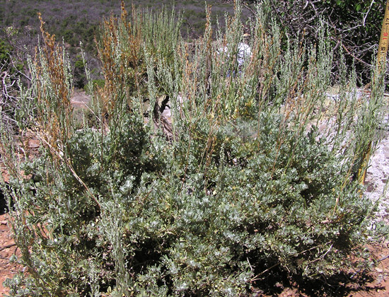
Big Sagebrush Species
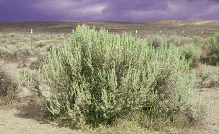
Big sagebrush species (Artemisia tridentata) are divided into four subspecies:
| Big Basin Sagebrush
Artemisia tridentata tridentata |
 |
| Wyoming Big Sagebrush
Artemisia tridentata wyomingensis |
 |
| Mountain Big Sagebrush
Artemisia tridentata vaseyana |
 |
| Scabland Big Sagebrush
Artemisia rigida |
 |
The dominance of Artemisia species is due to two primary factors:
- Dimorphic leaves. The species has large ephemeral leaves that develop in late spring to maximize photosynthetic capacity and growth. The large leaves remain until moisture stress develops in summer, then they drop and give way to smaller leaves that reduce moisture loss through transpiration. These remain until the following spring.
- Phreatophytic rooting system. The species has both fibrous lateral surface roots that can draw water and nutrients near the surface and a taproot that can obtain water and nutrients from deep in the soil profile.
One may logically conclude that if sagebrush is removed, soil moisture increases. This is true, but only at a certain rooting depth. Also of note, big sagebrush species are not tolerant of flood conditions for more than two or three days.
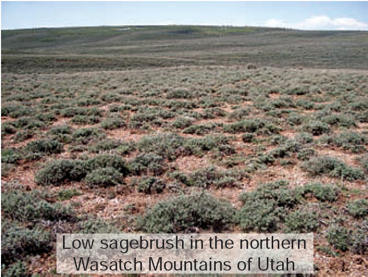
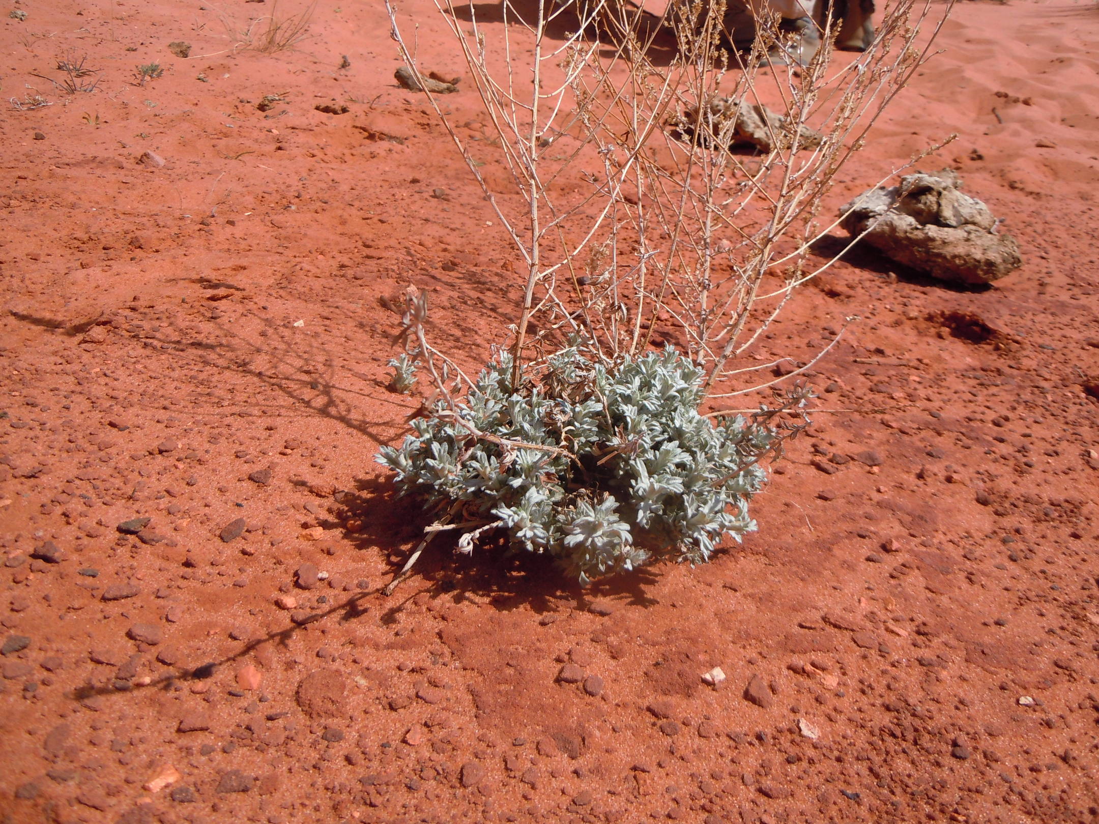
Low Sagebrush Species
Low sagebrush species include the following:
| Low Sagebrush
Artemisia arbuscula |
Low-growing evergreen shrubs usually less than two feet tall with multiple stems that appear to rise from the ground, often lacking an apparent trunk. Plants are usually found on shallow clay or rocky soil “islands” amid large stands of big sagebrush. |
 |
| Bigelow Sagebrush
Artemisia bigelovii |
Bigelow sagebrush is distinctive for its small, round (not bell-shaped) flowering heads, wand-like stems, and leaves with pointed lobes. Even so, this lovely silvery-leaved shrub is often overlooked because it can blend in with other gray-colored sagebrush. It grows primarily in sandy or rocky soils of warm deserts. It is sometimes called “plateau sagebrush” for its occurrence in slick rock habitats of the Colorado Plateau region of Arizona and Utah. Bigelow sagebrush also occurs in the short-grass shrubland of west Texas and New Mexico, the Mohave Desert of Arizona, California, and southern Nevada, and it extends north into the frigid clay soils of the Uinta Basin of Utah. |
 |
| Silver Sagebrush
Artemisia cana |
Silver sagebrush has long, mostly entire leaves, and it freely resprouts after disturbance. Its deciduous habit and tendency to grow in sites that are wet or seasonally waterlogged distinguishes it clearly from the evergreen big sagebrush. Great Plains weather influences its distribution. A. cana resprouts from fire and other disturbances. There are three subspecies of silver sagebrush that are geographically distinct: (1) Bolander sagebrush (subsp. bolanderi) occurs from the Sierras of California to Oregon, usually on poorly drained clay soils or in standing water. It is highly variable in morphology, ranging from short to tall plants with narrow or broad leaves. (2) Mountain silver sagebrush (subsp. viscidula) is the most abundant of the three subspecies of silver sagebrush and is distinguished by its somewhat sticky (viscid) yellow-green or gray leaves. It is found in mountain meadows, along streams, or in depressions with late-lying snows. (3) Plains silver sagebrush (subsp. cana) is taller and bushier than the other two subspecies and is found in areas with summer rain, primarily east of the Continental Divide in deep, loamy soils. |
 |
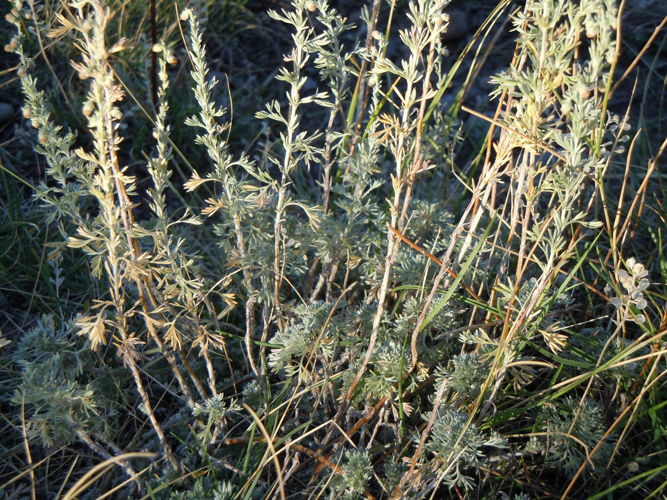
| Fringed Sagebrush
Artemisia frigida |
Fringed sage forms distinctive mounds, and it is the most widely distributed of all the species of Artemisia. It is found throughout the northern hemisphere from boreal regions near the Arctic Circle to the cool-season grasslands of Asia and North America. It is found in shallow soils that are regularly disturbed by either natural forces (e.g., wind) or mechanical disturbance. Widely distributed and highly variable, this species has recently been marketed in the horticultural trade. Fringed sage is the only species included in this guide that has a hairy receptacle. |
 |
| Black Sagebrush
Artemisia nova |
Black sagebrush has leaves that are darker green than other species of sagebrush. The dark green glands exposed on the sparsely hairy surface are often used as a way to identify the species. The glossy flower bracts and reddish-brown persistent flowering stalks also help to identify this species. Black sagebrush is highly drought-tolerant and often found on dry microsites such as west- or south-facing slopes, usually in shallow, rocky, calcareous soils. |
 |
| Bud sagebrush
Picrothamnus desertorum |
Bud sagebrush is distinctive in a number of ways: it has spine-tipped branches (for which the species is named), flowers in the spring, and has large-headed yellow flower stalks tucked within the vegetative portion. The spiny stems, short flower stalks, and multilobed leaves make it unlike anything else in the sagebrush complex. It is extremely drought tolerant, often growing with saltbush, and is remarkably palatable to domestic livestock. It provides good forage during winter months, but it is potentially poisonous to young livestock if consumed in great quantities. It grows primarily in valleys, often in saltbush or greasewood communities. |
 |
Low sagebrush species generally occur where soil erosion in former big sagebrush communities has exposed the clay-textured and/or calcified horizons in the subsoil. These species are also more water tolerant and tolerant of monsoonal events that occur in the southern portions of the MLRA B and D regions.
General Characteristics of Sagebrush Species
Regardless of their classification as big or small, sagebrush species share a number of characteristics. They all belong to the sunflower family, or Asteraceae, even though they do not have the showy flowers that are common to most members of that family.
Many volatile compounds in sagebrush give it its characteristic odor. Many are produced in the glands on the leaves, which is why sagebrush smells so strong when you crush the leaves in your hand. Some of these compounds confer protection by deterring insects and other predators, and some of the compounds actually attract grazing animals. Water-soluble coumarins and other compounds fluoresce under ultraviolet light, and the presence of these compounds correlates with increased palatability. Determining the presence of coumarins can thus be used as a measure of a plant’s relative importance to wildlife. The volatile compounds as well as other secondary compounds also have antibacterial properties that have led to numerous medicinal uses of sagebrush as well as ritualistic cleansing.
All Artemisia species are fairly prolific seeders following flowering in late summer or fall. Rather than depending on insect pollination under cold desert conditions, sagebrush depends on wind for pollination. Seeds germinate in late winter or early spring, and once past the seedling stage, they are generally long-lived. Sagebrush does not resprout, which is why when burned or mechanically removed retrogression to substantially earlier successional state results.
Section 4: Succession and Retrogression in Sagebrush Ecosystems
Sagebrush ecosystems have a high degree of disturbance, whether from overgrazing, land conversion, fire suppression and resulting woody species encroachment, invasive species establishment and proliferation, or other land uses such as recreation. Although we cannot cover all variations of succession and retrogression across all ecological sites of the MLRAs covered in this text we can review a few examples that reflect generalized ecosystem change across sagebrush ecosystems.
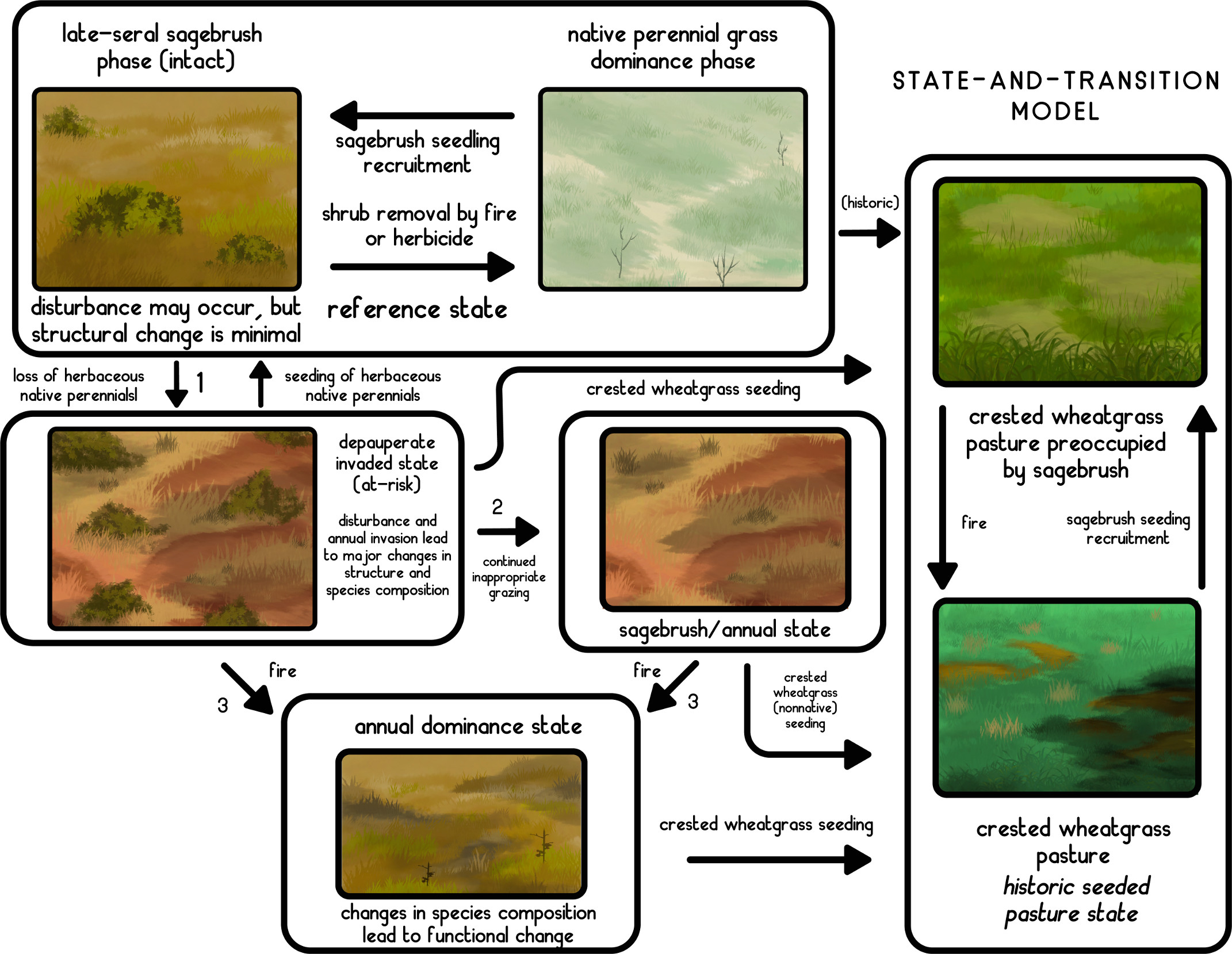
Historic Nonnative Crested Wheatgrass Seeding
Many areas of the “B” MLRAs were subject to land conversion due to homesteading activities in the mid to late 1800s. In the early 1900s, due to economic downturn and the Great Depression era, many of these homesteaded areas were abandoned and subsequently returned to federal ownership. To “rehabilitate” these areas to make them once again “productive,” in the 1950s they were seeded with nonnative species, largely crested wheatgrass (Agropyron cristatum), a palatable forage for cattle. These areas were then subject to grazing pressure. The state and transition model below reflects the impacts on sagebrush systems throughout Oregon, Idaho, Wyoming, and northern Nevada from overgrazing, crested wheatgrass seeding, and cheatgrass invasion.
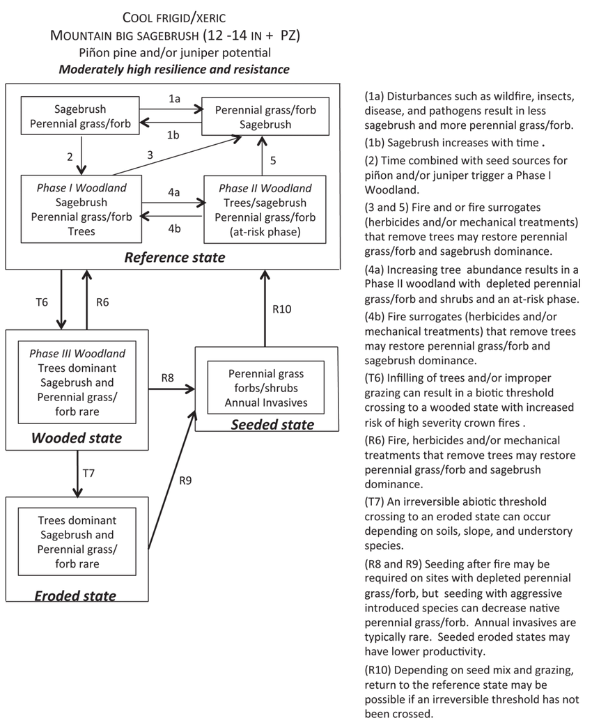
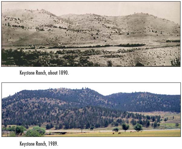
Juniper-Invaded Sagebrush System
The image in figure 8.25 depicts a common occurrence across many of the MLRAs of sagebrush systems. Historically, juniper species are found on rocky hillsides, but as a result of overgrazing and fire suppression, juniper species have continuously proliferated down hillsides and into lower-lying areas of sagebrush sites. North of Utah or lower Idaho the encroachment is limited to juniper species, but from northern Utah south, the encroachment is either juniper species only or a mix of juniper and pinyon pine.
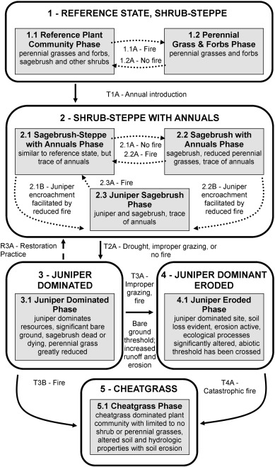
Following the state-and-transition model (STM) (figure 8.25) we see that the process of juniper encroachment begins with fire suppression and establishment of annual invasive grasses; the process is then exacerbated by continued fire suppression, overgrazing, and drought condition. As the grass and forb community in the juniper-invaded site is reduced, soil stability decreases and soil erosion increases, creating a positive feedback loop that accelerates woody species and annual invasive grass proliferation.
Figure 8.26 presents another STM example of the progression from a sagebrush system to a tree-dominated (here pinyon-juniper) system. This site is more southern and at a higher elevation; however, the same drivers (fire suppression and invasive annuals) of system change apply. STMs across sagebrush systems largely tell the same story.